Super Typhoon “Dolphin” Intensifies Rapidly
Super Typhoon “Dolphin” Intensifies Rapidly
Could Challenge Historical Records
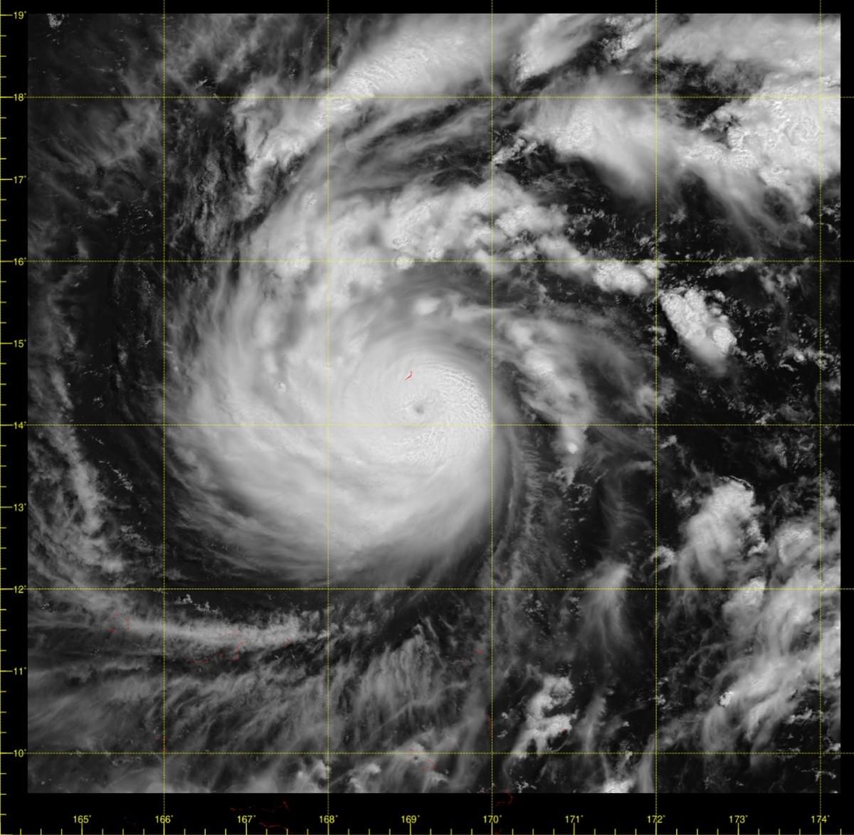
Tropical cyclone “Dolphin” (白海豚) has undergone explosive intensification over the past three days, rapidly strengthening from a tropical storm into a super typhoon and raising the possibility that it could become the strongest storm of 2026 in the western North Pacific.
According to the Hong Kong Observatory, numerical weather prediction models and artificial intelligence systems have forecast that Dolphin’s central winds could intensify further and approach historical extreme values. The storm’s name was contributed by Hong Kong and refers to the Chinese white dolphin, a local mascot found in the Pearl River estuary.
In just three days, Dolphin intensified into a super typhoon with maximum sustained winds near its centre reaching 270 km/h. This intensity is equivalent to a Category 5 hurricane on the Saffir-Simpson scale used in the Americas.
The Observatory noted that the storm features a small, well-defined eye and a symmetrical structure with vigorous convection near the centre. Favourable environmental conditions, including extremely high sea surface temperatures and weak vertical wind shear, are supporting further intensification.
The strongest tropical cyclones on record in the western North Pacific remain Super Typhoon Tip (1979), with a central pressure of 870 hPa and maximum sustained winds of 305 km/h, and Super Typhoon Nancy (1961), which recorded a central pressure of 885 hPa and the same wind speed.
Whether Dolphin can approach or challenge these historical extremes will depend on several key factors, including:
Continued high ocean heat content and sea surface temperatures along its path
Persistence of weak vertical wind shear
The absence of disruptive dry air intrusion or significant eyewall replacement cycles that could interrupt intensification
While computer models currently simulate a highly compact and intense circulation, the Observatory cautioned that intensity forecasts still carry uncertainty due to these complex atmospheric processes. Track and intensity details also differ among models.
Dolphin is currently moving west-northwest and is expected to remain over open waters for the time being. Residents planning travel to Japan or Taiwan in early August are advised to monitor the latest forecasts closely, as the storm’s path and intensity may still evolve.
The Hong Kong Observatory continues to track the system and will provide further updates as the situation develops.